What It Does
Topograph transforms images, video, or procedural sources like fractal noise into elevation maps and topographic visualizations. It works by converting the input into a 3D landscape, slicing it horizontally at multiple altitudes, then rendering the contours of each layer as a 2D image. The result is a distinctive topographic line effect suited to both static design work and animation.
Key Features
Interactive design feedback. Work on single frames with real-time parameter adjustments, useful for print or poster design where topographic aesthetics fit the concept.
Animation controls. Adjust elevation levels, line thickness, offset values, and colors through an interface built for motion work. Animate terrain reveals, text treatments, or abstract patterns without extensive manual masking.
Sub-pixel precision. Render at 2x, 4x, or 8x precision to capture detail below single-pixel resolution, important for sharp contour lines on complex source imagery.
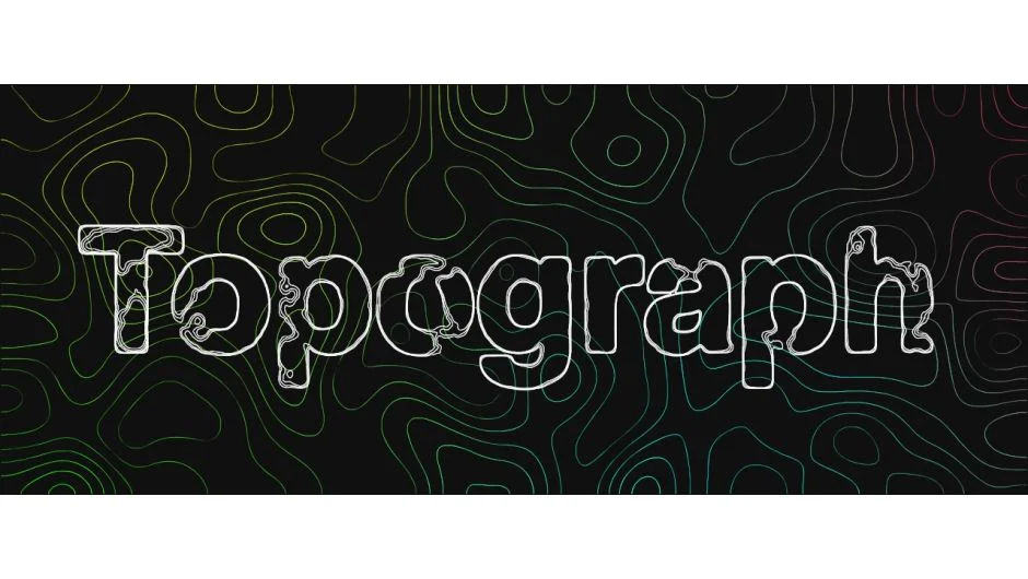
Procedural inputs. Feed the effect fractal noise, gradients, or live footage. Text layers produce topographic typography. Landscape photos produce literal elevation maps. The variety of inputs makes it adaptable to different creative approaches.
Multiple rendering methods. Choose different line rendering techniques for varied visual effects, from clean technical diagrams to stylized artistic output.
Who It’s For
Motion designers creating title sequences or abstract visualizations will find direct use cases. Print designers working in After Effects can generate topographic artwork for static compositions. Broadcast designers needing data visualization or infographic treatments can apply it to maps, charts, or conceptual graphics. It’s particularly useful when typography needs a technical or geo-inspired aesthetic.
Pricing
Topograph uses a pay-what-you-want model. You decide the price, with a suggested retail of $149.99 (currently on sale for $112.50 as reference). A trial version is available. Single user, floating server, and render-only licenses are offered. Full documentation is at topograph.gabgren.com.